Duck Science at Scale: AI, Satellites & the Future of Conservation (Ep 776)
What's the photo that accompanies that one sentence? Is it somebody squeezing squeezing the poop out of a duck? Is it the swab of the We're not
Jerad Henson:doing that. I think there may be a picture in there of, one of Patrick's team holding a duck, Okay.
Mike Brasher:It's a it's a family family friendly
Jerad Henson:It is a family friendly image. Yeah. Yeah. Might try and see if I could flash up a a duck poop image on the screen for everybody to enjoy.
VO:Can we do a mic check, please? Everybody, welcome back to the Ducks Unlimited Podcast. I'm your host, doctor Mike Brasher. I'm your host, Katie Burke. I'm your host, doctor Jerad Henson. And I'm your host, Matt Harrison. Welcome to the Ducks Unlimited Podcast, the only podcast about all things waterfowl. From hunting insights to science based discussions about ducks, geese, and issues affecting waterfowl and wetlands conservation in North America. The DU Podcast, sponsored by Purina Pro Plan, the official performance dog food of Ducks Unlimited. Purina Pro Plan, always advancing. Also proudly sponsored by Bird Dog Whiskey and Cocktails. Whether you're winding down with your best friend or celebrating with your favorite crew, Bird Dog brings award winning flavor to every moment. Enjoy responsibly.
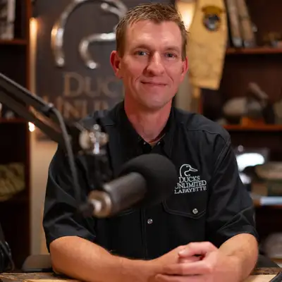
Mike Brasher:Everybody, welcome back. I am your host on today's episode, Doctor. Mike Brasher. I'm thrilled to be joined in studio by my cohost, Doctor. Jerad Henson Jerad, it's been a while since we've been on an episode together.
Jerad Henson:It has been. I'm excited to be back in a room and getting to talk talk some science, some duck science
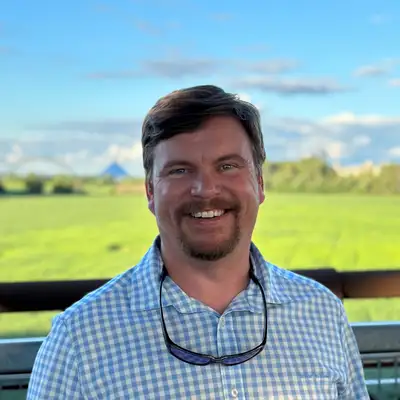
Mike Brasher:with We get to talk some duck science, some wetland science. We're gonna go out West again. We spoke with Jeff McGrary not too long ago for a high level update about the Western Region, but we're gonna talk science, waterfowl science, wetland science, artificial intelligence, new technologies, all sorts of cool stuff. And to help us with that conversation is a new, still relatively new, Ducks Unlimited staff member, Doctor. Patrick Donnelly, research with Ducks Unlimited's Western Region.
Mike Brasher:Patrick, welcome to the podcast.
Patrick Donnelly:Thank you, guys. Happy to be here.
Mike Brasher:We are going to start with a quick introduction of who you are, what your background is. You're working actively and have been in this rapidly evolving space of artificial intelligence, machine learning, big data. I've always described you as a spatial ecologist, someone who studies wildlife, who studied a lot of birds in your career, but you study how those birds interact with the landscape at very large scales and how those interactions change through time. I hope my understanding of that is reasonably accurate. But give people an idea of who you are, your background, and and then how you came to Ducks Unlimited.
Patrick Donnelly:So my background, it's kind of a winding road, I guess. It started with the Fish and Wildlife Service about twenty five years ago. So I've been with the service a long time before DU, and I was in the National Wildlife Refuge program and the Migratory Birds program. So first, looking at questions and things around kind of that that managed wetland unit scale. And and as you get involved with those types of things, you know, you're always looking over across the the blue goose sign.
Patrick Donnelly:Right? The blue goose signs that surround National Wildlife Refuges. And watching those birds leave those places and wondering where they're going and what they're doing. And I just wanted things to be bickered. So my background really is in remote sensing, movement ecology, and systems ecology.
Patrick Donnelly:So, you know, scale becomes really, really important. And if you're dealing with waterfowl, that scale is is flyaways. Right? So in the Pacific Flyway, we're talking the YK Delta to Zacatecas, Mexico, or the Yucatan Peninsula. During my first kind of time and space, you know, in the profession, we didn't really have the tools to to garner those scales of kind of reference.
Patrick Donnelly:We we're putting bands on ducks in Canada. They're getting shot somewhere in the wintering ground, and so we have a we have two points of reference. Right? And there's all this time and space in between, and I was always yearning for wanting to fill those spaces with something that was meaningful. And so realizing that refuges or postage stamps within the flyaways, how could I get to something bigger?
Patrick Donnelly:So I moved over to the migratory bird program. I was part of the Intermountain West Joint Venture as a scientist there based in Missoula, Montana, where I still am today. And the Intermountain West Joint Venture touches Canada on the North end and and Mexico on the Southern end. So now I had a I had a much bigger playground to look at beyond just these postage stamps of of refuges. And so I was unique in a way that I'm I'm based at the University of Montana wildlife program.
Patrick Donnelly:It's where I got my PhD in wildlife biology. And we have resources here that have been pushing the envelope of what you mentioned, Mike, is, you know, this AI cloud based computing and integrating those into to large scale things, you know, movement. Along came technology built around, you know, GPS transmitters that got smaller and miniaturized and light enough we can start putting those on birds. And so all of a sudden, what used to be just a band on a duck and two points in time and space, where now we're collecting points on a bird every 30, and we're looking to see how those birds are moving from Canada to Alaska down to California, Arizona, Idaho, all those places in between. And that really got me thinking about, okay.
Patrick Donnelly:Now we have technology that's filling in the gaps as these birds move across a landscape, but how do we fill in the habitat gaps on top of that? Why are those birds making the decisions that they're making? And so linking back to my colleagues here at the University of Montana, they were developing these really, really cool cloud based models looking at rangeland conditions. I got involved a lot in sage grouse. There was a time in my career where I was doing rangeland kind of modeling and determining how these birds were structured across landscapes, but I really wanted to link it back to to waterfowl and migratory bird.
Patrick Donnelly:And so my first kind of episode in this was dealing with sandhill cranes, bigger bird, big transmitter we can put on their legs, and those guys are what I call their metronomes of kind of migratory bird species. They collect a lot of really good data. The transmitter's really, really robust. These birds live really long lives, and so we can get lots of data going back and forth. And I begin building models looking at wetlands, how often they're wet, where they are.
Patrick Donnelly:Our most recent model we built covers the entire West, over forty years of where things are wet and dry. Through cloud based computing, there's 248,000,000 records in that dataset. We smash that together with these bird movements, and all of a sudden, we have these models and these storytelling events from conservation that are allowing us to find the best places to invest our conservation dollars that have the maximized value in return. All this means is that from a DU perspective, we have this, I guess, embarrassment of riches now and how we can really structure how we think about the West, how we invest those resources, maximize our returns, and really ensure that our members that are giving their hard earned dollars to support waterfowl for doing it in the right way. So I'm really a you think of me as, like, an investment broker for conservation.
Patrick Donnelly:Those are the models we're building portfolios for conservation investments. That's that's my that's my short and long story of where I've been. I've I've, you know, recently transitioned from the Fish and Wildlife Service about nine months ago to DU, and I'll tell you what. When you work for a federal agency, you get to do great things, but bureaucracy, funding, budgets really limit those ideas sometimes, not in a bad way, but just, you know, there's things you kinda run up into. I've been a kid in a candy store the last nine months because in a DU's perspective, we kinda remove some of those sideboards.
Patrick Donnelly:Since I've been here, we started the largest kind of movement ecology study for Mallards in the Pacific Flyway, something I never could have done within the service. But in DU's world, it's something that's possible. So I'm excited to talk about that. Other things we wanna talk about today, all in front of us. Really, really cool stuff.
Mike Brasher:Yeah. You you said kid in a candy store, and as you were talking, I that was one of the questions I was gonna ask you is, given your background, given the area that you've the area where you've worked, the questions you've worked on, the scales at which you've you've tried to operate, this time right now with more data, more computing power, machine learning models, your mind just has to be going nonstop, generating ideas and imagining ways, new ways of of trying to answer questions. You probably still have some of the same questions that you've always had, but now you have different data sets to bring to bear on answering those questions. So it's got to be exciting, and also the fact that you're not constrained as much by the bureaucracy that you have to deal with in some cases.
Patrick Donnelly:Yeah. You know, a lesson I learned early on when we started down this road of cloud computing and AI, and this is this is back, I mentioned the rangeland stage grouse world, I'd leave I'd leave meeting rooms with my colleagues, and we'd stand in the hall and look at each other for, like, five, six seconds. Know, you know what? We're not thinking big enough. Not scaling our ideas.
Patrick Donnelly:We're we're trying to catch up to the technology. And when you're in that place, it feels like you're surfing a wave. And I think in the waterfowl world, which is traditional in some ways, we have very kind of a long history of how we've done things in the past and what we perceive waterfowl habitats, waterfowl ecology to be. There's some challenges even in that space to to layer on some of these bigger perspectives and what could be done. And so there's almost an educational outreach to our colleagues across that that that discipline.
Patrick Donnelly:And as people see those ideas and they begin to come along with you, you have that same hallway realization, like, you know what? We're not thinking big enough. That's really, really exciting.
Jerad Henson:And I think you made a really cool point there, and it's something that I've recently learned through some conversations we had, I guess, a few months ago, that education side of it is super important too, and you even have taught classes on Google Earth Engine and using that for ecological studies. So not only are you doing this, you're trying to bring the scientific community up so that we can keep moving those questions forward. Can you tell us a little bit about kind of just high level on what that class is teaching, what those students are learning?
Patrick Donnelly:And so when you when you think about the challenges of of when when, say, the three of us were going through our education and we're dealing with, say, an organism, waterfowl, there's elk, there's cranes, whatever those might be, we were really just given the task of understanding how these critters were interacting with the landscape. We assumed that landscape to be pretty, you know, static. Not not static totally. Things get wet and dry and things go along. But but now these trajectories some landscapes are on are what call nonstationary.
Patrick Donnelly:They're they're kind of evolving into a new kind of place of equilibrium. And we're asking the students to make these kind of relationships and understand what's going on, but we don't give them the tools to actually reconstruct, understand what's happening on the ecological or habitat side. So our new biologists, and this goes even for, I think, DU as a whole, is we're trying to keep up with these kind of changes that are occurring across the flyways and also maintaining this relationship with what waterfowl and how they're interacting with those, and it just gets to begin kind of overwhelming in the context of those kind of interactions. So we're giving students tools and exposure to these cloud based models so they can build these things and keep pace with all those types of changes. So when they get hired by DU or they get hired by a state agency, they have those kind of, like, wrenches and screwdrivers and things in their back pocket to really do those things to answer the questions that are gonna be really at the the head of of what's driving waterfowl populations and landscape change coming into the future.
Mike Brasher:Patrick, we'll pop around here and talk with you about some of the work that you've done on any one of these things. We could go into a lot of detail, but we'll try to avoid that, and we'll come back later on in future episodes and and maybe dig into the details. I wanna first talk with you have you talk about some of the work you've been doing for I don't know if it goes back a decade or not, but it's it's really rooted in the application of satellite imagery and some of the other sort of image processing tools that we now have available and that have been advancing to to obtain sort of large scale assessments of of wetland change. Most often within our conversations, we we talk about wetland loss, this idea that that a wetland is drained or a wetland is is is dry and forevermore dry, it's either filled or drained or whatever. There are changes in wetlands that occur short of that complete drainage action for whatever may have have caused it, and you've studied that quite extensively in the Pacific Flyway, not just in The US, but extending into Mexico as well, and you've you've kind of framed that, the consequences of of the changes that you've seen in in wetland conditions around its impacts on on migratory birds, and so walk us through some of that, the the nature of those questions.
Mike Brasher:You call it functional wetland loss, the idea that wetlands may still be there, but over time, they have changed in their permanence or their extent as driven by a host of factors. And so help people understand that question that you've been studying and why it's important from DU's conservation perspective.
Patrick Donnelly:That's a really good one, Mike. So out West and in other places too, and this this is occurring in many other places than just the West, but we started here because we had we had experience, and we're trying to understand what's going on. Basically, we do a good job of protecting the land the wetlands encompass, but the water inside those systems, like you said, is is doing different things. We make things a little bit warmer. We change our snowpack a little bit.
Patrick Donnelly:So in the West, wetlands are ruined by snowpack. Snows a lot, high elevations, and the spring, it melts, and it comes down and fills these basins, recharges groundwater. As we've gotten into it, I mentioned earlier the student idea around what we call these nonstationary effects is wetlands go through cycles of wet and dry, but we're pushing the whole systems closer to dry. And as we do that, going back and just looking at a wetland and assuming that it's still there because there's still a base in there was really not addressing what the new stressors are. The stressors are drying and lack of water.
Patrick Donnelly:And as we begin to count up how this is affecting wetlands, basically, what we saw was we looked at forty years of information using satellite data at monthly intervals, and we said, gosh. These places that used to always be wet, they're not wet anymore. And, really, that's the functional loss. So we we've protected the land, but not the wetlands. So how can we think about conservation design in the West around this idea that, you know, we may have be we may be evolving into a new state where the threats we thought historically, which are ditching, draining, drying, building a parking lot on top of a wetland, those are those other effects that we assume to be happening.
Patrick Donnelly:They're not happening anymore. The new threat is drawing across the West. And so understanding how those events are occurring and what individual species, waterfowl, and what life stages, breeding, migration, wintering, are most impacted become critically really critical kind of issues to understand, and all that information goes back into our conservation planning so we can be very targeted and direct to offset those changes into the future.
Jerad Henson:Patrick, that was a a really good overview of that. And just for our listeners, do you mind reiterating, because you hit one sentence on it, the importance of the those different types of wetlands. Right? A wetland is not just a wetland to a duck. The different types of wetlands are really important in those different life cycles and life stages.
Jerad Henson:Do you mind just kind of high level view of of why that matters from a waterfowl management standpoint?
Patrick Donnelly:You think of I think of hydrology, really. Hydrology is the Rosetta Stone of how wetlands work. It's what kind of food they provide, what kind of cover they provide, and a duck looks at that that system during different life stages, during brood rearing. Those birds out west are looking for these systems that are very predictable. They're almost always wet through late summer.
Patrick Donnelly:We call them semi permanent systems. Those same types of systems, semi permanents, are really important during molting. So we all know that waterfowl are catastrophic molters. They lose their ability to fly for about thirty five to forty days. They settle on these large semipermanent systems that give them the ability to stay safe and find food.
Patrick Donnelly:Ironically, those types of systems remember, things are getting drier, so semi permanent are shifting to seasonal systems. Those are systems that have different types of resources that are, say, that that wetland's only wet, say, for six or nine months of the year, typically dries up by late summer. As we've seen this transition, disproportionately semi permits are being affected. So brood rearing, you think of, and molting are disproportionately impacted by those those effects. And I'll give you one, like, real world example.
Patrick Donnelly:So what we call this landscape called Sonic. It's Southern Oregon, Northeast California. That's the acronym. Huge place for molting ducks in the West. So we have our regional breeding ducks, a lot of mallards, lot of gadwall, that aggregate around these large kind of semi permanent systems in the Klamath Basin that's in Sonic.
Patrick Donnelly:Last year, at the Klamath Refuge Complex, they picked up a 160,000 birds, so you get botulism outbreaks. You get more ducks packed into smaller places that are somewhat burns, warmer temperatures, and those can drive disease outbreaks. So being cognizant of what these effects are gives us the ability to offset again those impacts, but understanding what types of wetlands are being impacted translates directly to effects on waterfowl and how we can manage to avoid those impacts.
Mike Brasher:Patrick, have we have you I think the answer is yes, but I'm gonna ask this because I don't remember. Have you combined any datasets on bird movements or long term bird movements, bird abundance to see how their distributions, the timing of their distribution may have or abundances may have changed in response to the the functional shifts in in those wetlands, whether it's one species or an assemblage, a suite of species.
Patrick Donnelly:We've done that looking at, actually, EBIRD data. Yeah. So, you know, we've got this long dataset now of of changing wetland conditions at at fine details of scale, and we've leveraged, you know, Cornell Lab of Ornithology, their amazing long term citizen science datasets, and we smashed them together. And when you do that, you understand what's important to ducks and how those resources have been changing through time, and it's a template we can can use the Western models we developed. We can sit anywhere essentially on the globe if we wanted to understand those same relationships.
Patrick Donnelly:Really exciting stuff.
Jerad Henson:That's really cool.
Mike Brasher:Patrick, I think we wanna take a break right now. I'm looking at the clock. We've been talking for almost twenty minutes now. So we wanna take a break. Then we want to talk about some of the other exciting projects that you're working on, many of which intersect new technologies.
Mike Brasher:Some of them intersect new areas where we're where we're working or at least we're expanding our work, and I'm I'm thinking about Alaska, and there's some other exciting stuff going on out there. And so we want you to walk us through some of that. So stay with us, and we'll be right back
VO:Stay Tuned to the Ducks Unlimited Podcast sponsored by Purina Pro Plan and Bird Dog Whiskey after these messages.
Mike Brasher:Hey, everyone. Welcome back. We are here with doctor Patrick Donnelly, a research scientist for Ducks Unlimited's Western Region, and you've got some exciting projects going on. I'm gonna shift to Jerad here because, Jerad, you have been talking with Patrick quite a bit here lately about some of these of these new exciting technologically based tools, techniques, studies that Patrick and other people are involved in because you have a presentation upcoming I do. At National Convention on the main stage at National Convention.
Jerad Henson:It's gonna be a lot of fun talking about new techniques, how we're integrating those into to being able to deliver much better conservation across the continent.
Mike Brasher:And there are a there are a number of people in the organization that have that you've been talking with that are contributing to the the material that you'll you'll be presenting, but Patrick has been part of that.
Jerad Henson:Patrick's been a bunch.
Mike Brasher:It's been fun, I think, for you learning about that.
Jerad Henson:Has. It has. And it's actually is thanks, Mike, for this because I I really like this because the talk that I pulled together on this new technologies, I think, falls perfectly into Patrick's wheelhouse because the kind of overarching aspect of what I'm gonna be talking about is really his approach, and it's taking movement data on birds and occurrence data, pairing that with habitat data in some way, shape, form, or fashion in real time. That's the kicker, is this this new in the new technology side is that ability to look at things at a much higher frequency, a much better temporal scale, and actually start to draw conclusions on when and what are important to bird species in general. So with that, I would love to ask Patrick on that framework.
Jerad Henson:Like, what's his favorite before we even jump into the specific projects, what are the technologies that you're leaning on right now? Just high level, you don't have to go to to the nth degree, but, like, what technologies do you think are the biggest game changers for this type of work?
Patrick Donnelly:I mentioned it earlier. It's this miniaturization of GPS technology that allows us to put that tracker on a bird. That's it. Follow it around every every thirty minutes, even fifteen minutes, depending. We can get a point where that bird is and track it across the continent.
Patrick Donnelly:That's that's a game changer.
Jerad Henson:And some of those units even have little accelerometers, basically, like a little step counter in them, and you can, you know, collect some basic behavior data
Patrick Donnelly:You can.
Jerad Henson:From that as well. So not only do you have a location, you have a behavior potentially with that overlaid on some temporal or on the habitat, which is pretty neat. And then on the habitat side, what do you think is the biggest game changer?
Patrick Donnelly:It's what we've been talking about. It's it's getting to understand the hydrology of the wetlands. So I talked about semi permanence, seasonals, and we didn't talk about temporaries. That's another one. We can tell you what kind of hydrology that bird's tied to, and if it's wet or dry at that same time, and we can look around the surrounding landscape, looking at wetland density.
Patrick Donnelly:We can look at up grasslands that are occurring there. We can look at agriculture all in real time and space, and that's that's helping us tell this real story of how that bird's interacting with the landscape, and that's just never happened before.
Mike Brasher:I wanna interject here and ask Patrick to add some add some color to one of the one, I guess, one of the analyses that we that's sort of behind a lot of this, and that is the remote sensing, the the classification of satellite images. Let me just say it like that. Yeah. And to give people an understanding, because we hear about that all the time, spy satellites in or in the news and and, you know, the high resolution satellites that are providing imagery of activities and events that are happening all across the world, but a lot of those are commercial satellites, the very high resolution submeter resolution. We don't we're not really afforded the luxury of dealing with imagery or satellite imagery from at that finest scale, at least not regularly, but give people an idea of of what we do have access to, the length of time we've had those, the resolution of those, what are the primary frameworks and platforms that we're using?
Patrick Donnelly:So it started with NASA in 1984. They had this vision of understanding, you know, earth's functions in ways that we haven't had access to at the time. And so they started what they called the Landsat program. Basically, you put a satellite in the air, and the sucker, you know, rotates around the earth, and it continually takes pictures. Every single say, Landsat comes back to the same place on the earth every two weeks, snaps another picture of that.
Patrick Donnelly:All that time from between '84 and now, we've been doing that. So we've got this forty year catalog of changes across the globe. And, historically, those data have always been there, but it's been really arduous to go back and reconstitute those things and make the measurements we can extract from those pictures essentially, tell you where all the water is, tell you where the grassland is, tell you what's changed over time. But with cloud computing now, we smashed Google cloud computing with that. And now what would take us months and years and many, many millions of dollars in technicians to reconstitute some of these measurements, it's some pointy head DU scientist sitting in an office in Missoula, Montana with some code can do that in minutes in what would take us months.
Patrick Donnelly:And so we're leveraging that technology to close those gaps in our understanding of satellite data and bring all back to waterfowl.
Mike Brasher:And so Landsat, I wanna help people understand some of of what we deal with when we're looking at these images. Landsat is 30 meter pixel resolution. Right? So it's not like we can see individual ducts. We can't see individual cars.
Mike Brasher:We can't see license plates.
Jerad Henson:For our listeners out there, I think a really good kind of analogy or or or a way to to visualize this is if you go to On X, which a lot of people have, you use the recent imagery
Mike Brasher:Okay.
Jerad Henson:And it gives you an every two week scan Yep. That's that's that data set.
Mike Brasher:But that's not Landsat. That would be Sentinel.
Jerad Henson:It's Sentinel. It's Sentinel, but it's a similar type framework. It's the Correct. Similar resolution in that that but that ability to see things on that kind of timescale versus I can remember in, like, college looking at some Google Maps, and, you you had to wait a year plus to get an update on a map on Google Maps or something. Right.
Jerad Henson:You know, the thought now that you can have a new scan with, say, Sentinel in five days.
Patrick Donnelly:We're getting them three days after the picture's been taken.
Jerad Henson:Yeah. It's like every five days or so, some of that stuff.
Mike Brasher:I was reading something in the news the other day that said, you know, China and The US are in this arms race to, you know, the spy satellites, surveillance satellites, and and I think China is moving towards having, I don't know, 200, 300 satellites in orbit that will allow them to take a high resolution, probably submeter resolution image of of the same place every ten minutes. Wow. It's kinda scary. Now we don't and I I wanted to go down this line because people that are keeping an eye on the news It's very interesting. Hearing about some of that, We don't have access in the natural resources community to that type of data.
Mike Brasher:We're dealing with now Sentinel, as we've referenced. That is a huge advancement. 10 meter resolution Correct. And a shorter return frequency. Is it five days?
Mike Brasher:Is it five
Patrick Donnelly:eight days?
Jerad Henson:Something like that
Mike Brasher:in it?
Patrick Donnelly:It's three three there's three optical satellites that take pictures of the the Earth, and that's three days now. There's one that uses radar, which is a little bit different technology that allows us to see through things like trees that kind of penetrate some things that are up there too. That's about every seven days now for Sentinel, I believe.
Jerad Henson:That was gonna be one of my my next little things is you're not just getting a picture. Yeah. You're getting data coming back in different wavelengths. You can look at things like primary productivity. You can look at water reflectivity, and that allows these models to get much cleaner and see through some of the noise.
Jerad Henson:Correct. And and Patrick's really good at it. I've seen some stuff he's done. And so I think that set that up really well. Can you talk about the Mallard project, the Western Mallard project that y'all have going, and kinda how it's utilizing all that technology just so people can see it all come together in a conservation kind of framework?
Patrick Donnelly:So so with mallards in the West, you know, you think about, why are why are we studying mallards? Mallard is a duck we know a lot about. Right? But in the West, a lot of that research has has been going on in the Mississippi Flyway, Central Flyway, the the prey puddle region, the duck factory. We need more information on what birds are doing in the West.
Patrick Donnelly:That concludes all birds that are breeding in Alaska all the way down to California and in the Intermountain West portion. So GPS technology. We're gonna put transmitters on 800 birds across the West, and that means working with our state partners that are usually going out and capturing birds and putting bands on them. Now we're training them to go out and put backpacks that have these GPS transmitters. Every every thirty minutes to an hour, we're gonna get a point.
Patrick Donnelly:Those birds are gonna fly from Alaska to the Prairies back to California and everything in between. And then we're reconstructing, like you guys have been alluding to, real time wetland information tied to those individual movements in birds. That's gonna give us some idea of what's important to those birds. And once we understand what's important in their distributions and where they're interacting with landscapes, we use Sentinel data for that. That's the stuff that we're that's higher resolution that you guys just referenced being collected now to build wetland models.
Patrick Donnelly:Then once we know it's important, we backcast forty years using Landsat data so we can look at trends in time. And once we get those two things together, we build conservation kind of designs and strategies that begin to address bottlenecks in the habitat in the right places. So when we take our harder conservation dollars, we know we're investing them in target locations that can maximize the biological returns to sustain those populations. So it's it's a way to really build a portfolio that ensures Mallards and Pacific Flyway will be functioning far into the future. It's super exciting stuff.
Jerad Henson:It really is. And one of the things that's cool in that Western region is you as you talked about going into Alaska, it's really hard to survey information and data in Alaska. So if you can do that from a remote sensing standpoint in a meaningful way, that opens a lot of doors on on understanding the importance of Alaska to all flyways because it's not just important to the Western Flyway. I have one white fronted goose band that I've gotten my entire life. It was banded on the North Slope Of Alaska.
Patrick Donnelly:Yeah. And so so think about Alaska. I mean, Alaska, the Mallard Project touches Alaska, but we also have this long history of breeding population surveys. You know? So we often talk about those in the Prairies and the PPR, and you guys have probably heard references to pond counts.
Patrick Donnelly:Right? We we fly low elevation. We count pairs of ducks, and ponds are really just how many of those basins are wet along that transect. And that becomes a habitat metric. How how how wet is the Prairies?
Patrick Donnelly:The wetter it is, typically, the more ducks we'll see returning to The States and during fall flights. Alaska, there's no ponds. You can't count ponds. They're just wetlands. And so we're we're gonna reconstruct forty years of habitat data and tie it back to those breeding population surveys, which is just pair counts.
Patrick Donnelly:And once we do that, we can begin to link those together to understand how population dynamics in Alaska are being influenced by changes in breeding conditions. We we're often think of Alaska as a place that's always wet. It's always doing good things. But you guys have seen the news lately. There's there's increased wildfires occurring across these areas.
Patrick Donnelly:That's because things are drying out. Things are changing. Salmon populations are chifting and crashing in some watersheds. Waterfowl are being influenced by those same effects. And measuring wetland conditions, and those riparian systems especially like Yukon Flats or the YK Delta, it's gonna give us incredible insight on how we can think about future policy, how we think about conservation initiatives that can really be targeted.
Patrick Donnelly:That includes the North Slope too, Jerad. I'm glad you mentioned your white fronted band because that is the breadbasket for a waterfowl species that are outside the Pacific flyaway but occurring in Alaska. And so up there, it's not just measuring wetlands, but actually vegetative conditions, expanding kind of Arctic goose populations or or overgrazing. There's theories and hypotheses impacting some of these resources. We can measure those at the same rates.
Patrick Donnelly:And so beginning to bring this this science, this cloud based computing satellites to bear, we're filling long term gaps in parts of the flyaway that have been black boxes for us for decades. And it's gonna really give DU an edge in communicating the importance of these things and informing policy and conservation, again, to ensure these populations that the entire continent's relying upon are in good hands.
Mike Brasher:You know, artificial intelligence is something that everybody hears about every day. It affects it's affecting so many different aspects of our life. It's affecting ours in conservation in a lot of ways, and we are hearing about some of that now and and how we're using it to accelerate our learning to deepen the nature of our learning, to expand the scales of our learning. All of that is, of course, important for improving the way we deliver conservation, making more informed decisions, and there's a host of other sort of technological applications that are out there. Jerad, are there others that you want to talk about right now that that you've spoken with Patrick about in the past that he's involved in, or we want to save those for later?
Jerad Henson:I think we can high level a couple little things. I think mentioning AI is is really important, and and Patrick, you said this earlier, the scale of data. It is insurmountable for a human to go through this amount of data. It's not feasible. It's been a barrier because of that, and now all of a sudden it opens doors because if you've got the right computing power, you can run through this thing in a night.
Jerad Henson:I'm not saying you're gonna click a button and it's gonna pop up ten seconds later, but these data sets are huge, but it's feasible now. We can now understand the the scope of these types of really big questions. I think it's really cool. It's also really good at picking out patterns and trends. I think that's something you can mention as well.
Jerad Henson:One other little thing I did wanna mention, just high level, because Mike, you know, loves his Duck DNA Oh, yeah. And we're gonna talk
Mike Brasher:Genetics and It's a field that is it is exploding because of new techniques, and it will benefit also from the additional computing power brought to us by AI machine learning and all that.
Jerad Henson:It is, and in the biodiversity world and just the natural world in general, people are asking questions about what organisms are out there, so inner eDNA, this environmental DNA, as we move through an environment, we leave traces of DNA as we move through it, all animals do, and it's really cool to see you start to add these other new techniques into these other projects. Right? You've mentioned briefly this high level Cinnamon Teal project where you're using the transmitters. You've got the land cover data, and now you're trying to get to diet questions. Can you take us just quickly through kind of how that's being incorporated to add more information to these stories?
Patrick Donnelly:Super exciting study. Great basin wide. Teal, like you said, being marked with GPS transmitters. All the wetland we know what the wetlands are doing because you have the hydrology. Now we're grabbing those ducks.
Patrick Donnelly:We're sampling. Basically, it's kinda squeezing the duck, get a little bit of poop, putting that poop in a jar, setting it off, and get that eDNA. So, basically, we understand now the dietary linkages between those birds and their utilization of those places they're occupying over time and space. So now it's not only telling us what they're going and the decisions they're making, but even finer scale dietary needs, that gets back to wetland management, what's important, what those gas might be. I mean, it's just another step down that storytelling, that conservation, really, gap we're filling and understanding what birds need and how we can provide those resources that are best for them.
Mike Brasher:And the reason that's possible is because we have genetic signatures for all sorts of plant species, all sorts of aquatic insects, and when you get that poop, I mean, that's the very basic field element of it, is you gotta get the poop from the duck. Right. And then you run that through the analysis, and you compare the DNA signatures in the poop to all these other DNA signatures that you have in your reference bank of seeds and insects and all that, and then that's how you figure out what your duck's been eating.
Jerad Henson:That's it. And it's I will say that bank is probably not super, super sophisticated now, but it's good enough for us to make some really solid decisions, and it's only getting better That's every the cool thing about it. That's why we wanna be in on the front edge of it, and that's why I get excited about it. I have a more of a molecular background, so seeing some of those techniques being used in ecological manners, it's always exciting for me to see that and talk about it.
Mike Brasher:You gonna are you gonna be talking about duck poop in your national convention presentation?
Jerad Henson:I have one sentence. One sentence. Okay. That that mentions it. I'm very limited on time here.
Mike Brasher:Well, I know. You gotta you have to select the most memorable, industry, deep, entertaining
Jerad Henson:because it's because I try to tell the story on being able to layer all of this new technology, these new data to make more informed decisions. What's the
Mike Brasher:photo that accompanies that one sentence? Is it somebody squeezing squeezing the poop out of a duck? Is it the swab of the
Jerad Henson:No. We're not doing any of that. I think there may be a picture in there of one of Patrick's team holding a duck, though.
Mike Brasher:Okay. A it's a family family friendly
Jerad Henson:It is a family friendly image. Yeah. Yeah. I might try and see if I could flash up a a duck poop image on the screen for everybody to enjoy. We'll see if comms will let me use an animation on there.
Mike Brasher:Make some changes at the last minute. They always love that. Patrick, any any concluding remarks from you? We're gonna wrap up here. We've we've been a fantastic guest.
Mike Brasher:There's tons of other exciting research and science that you're involved in. I know we'll have you back to talk about that in the future, but any final words for our audience?
Patrick Donnelly:Get ready because there's new science and technology coming. I think if there's readerships out there, podcast followers, that they're really engaged and stuff, In the coming years, we're gonna be able to show you and talk to you about things that that for decades have been eluding science in our kinda conservation community. It couldn't be a more exciting time. This is I'm in my mind, this is the second coming of what I I think of the original kind of waterfowl investment that we saw in the forties and the fifties. And, you know, this is the second coming of science, and, yeah, I'm super excited about it.
Patrick Donnelly:I'm super excited to be at DU and be able to share it all with you. And, yeah, it's gonna be fun.
Mike Brasher:Every passing week, I get another email about a discussion that we need to have with a certain set of partners to discuss how we may be able to help them with new technologies, new methods, to discuss potential application of some of these, and I anticipate that will continue. There are a ton of people that are working on these questions, you and your team out west. There are folks in the Great Plains that are working on this as well. We have folks in the Southern Region and the Great Lakes Region. Everybody's involved.
Mike Brasher:Everybody has their eye on these things within Ducks Unlimited, within our partner organizations. It's an exciting time. It's also a scary time in some ways just because of the how fast it's moving, you know? It's I mean, I guess it's it's it's scary and exciting at the same time, and that can be true, right?
Jerad Henson:It is. I think that's that's one and the same. Yeah. Because of the pace. Yeah.
Jerad Henson:And we gotta be careful about how we do it because of that, right? Make sure we're asking things appropriately because it does move fast enough that you could introduce some errors.
Mike Brasher:So as Patrick said, stay tuned. We're gonna be bringing information to you in all sorts of platforms. The podcast is gonna be one of those. Doctor Jerad Henson, I appreciate you being with us on this episode.
Jerad Henson:Thanks, Mike. I really appreciate it. It was great talking
Mike Brasher:to Doctor. Patrick Donnelly, thanks for joining us on the Ducks Unlimited Podcast.
Patrick Donnelly:Wonderful time. Glad to spend it with you guys.
Mike Brasher:A very special thanks to Doctor. Patrick Donnelly as a guest on today's episode. Also, thank my friend and colleague here, doctor Jerad Henson. We thank our producer, Chris Isaac, for the wonderful work that he does, getting these episodes out to you and to you, the listener. We appreciate your time.
Mike Brasher:We appreciate your support for wetlands and waterfowl conservation.
VO:Thank you for listening to the DU Podcast sponsored by Purina Pro Plan, the official performance dog food of Ducks Unlimited. Purina Pro Plan, always advancing. Also proudly sponsored by Bird Dog Whiskey and Cocktails. Whether you're winding down with your best friend or celebrating with your favorite crew, Bird Dog brings award winning flavor to every moment. Enjoy responsibly. Be sure to rate, review, and subscribe to the show and visit ducks.org/dupodcast. Opinions expressed by guests do not necessarily reflect those of Ducks Unlimited. Until next time, stay tuned to the Ducks.